
Surveying and spatial data specialists
Our Services
Torino Spatial provides specialised mine surveying, project surveying and Aerial surveying services. We offer a range of services, including survey relief contracting, mine control establishment, aerial surveying, re-traversing, and exploration surveys. With a strong focus on precision and compliance, we support mining projects with the critical spatial data needed for safe, efficient, and effective operations.
-
Torino Spatial’s team of experienced mine surveyors brings extensive expertise in both open-pit and underground mining operations. We offer flexible solutions for both short-term and long-term contracts, ensuring reliable and efficient surveying support.
Our surveyors are equipped to provide:
Survey control establishment
Grade 1 Senior surveyor contracts
Design and drafting services
Ore body mark-ups and pickups
Exploration surveys
Relief mine surveying
-
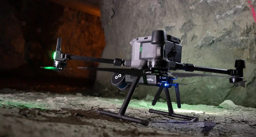
Torino Spatial’s team of qualified aerial surveyors specialises in capturing precise, high-resolution data for volumetric analysis, site inspections, and large-scale topographic surveys. Whether you require surveys for tailings storage facilities, end-of-month (EOM) stockpiles, or exploration sites, our on-site surveyors are fully equipped to handle any aerial surveying task with accuracy and efficiency.
-
Our team is led by Grade 1 Authorised Mine Surveyors with extensive experience in establishing geodetic-grade control networks for primary surface control and mine datum creation. We apply rigorous QAQC processes to ensure all primary and secondary surface and underground control is accurately recorded and fully compliant with statutory requirements.
Additionally, we assist survey departments in ensuring regulatory compliance through system and procedural audits, as well as supporting the development of mine and emergency plans.

about us
Torino Spatial provides precise and reliable surveying and spatial data solutions for both underground and open-pit mining operations. Our expertise ensures accurate data collection, supporting safer, more efficient, and compliant mining practices across all stages of a project.
With a team of highly skilled Grade 1 Authorised Mine Surveyors and aerial specialists, we offer tailored surveying solutions designed to meet the specific needs of mining projects. From volumetric analysis to establishing primary mining control stations, we provide the critical spatial data necessary for effective ongoing mining operations.
“Torino Spatial has been instrumental in developing and implementing new
procedures that have significantly improved our processes and efficiency.”
